Via the JP Gazette, I bring you the myNeighborhood Census Viewer, a fantastic new mapping application from the City of Boston. It’s a simple way to get info about any census block or group of census blocks in the city. Simply click on any area and you’ll see the census block highlighted, with all of the stats that the census collects on race, gender, age, household status, etc., displayed right there. You can also select multiple blocks through a variety of tools. It’s also a beautiful basemap with building footprints. Perfect for the armchair sociologist, historian, or cartographer!
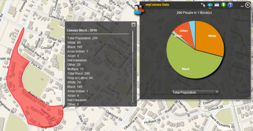
Here’s a view of the info for my census block.